


- All
- Blog
- Transport & Mobilités
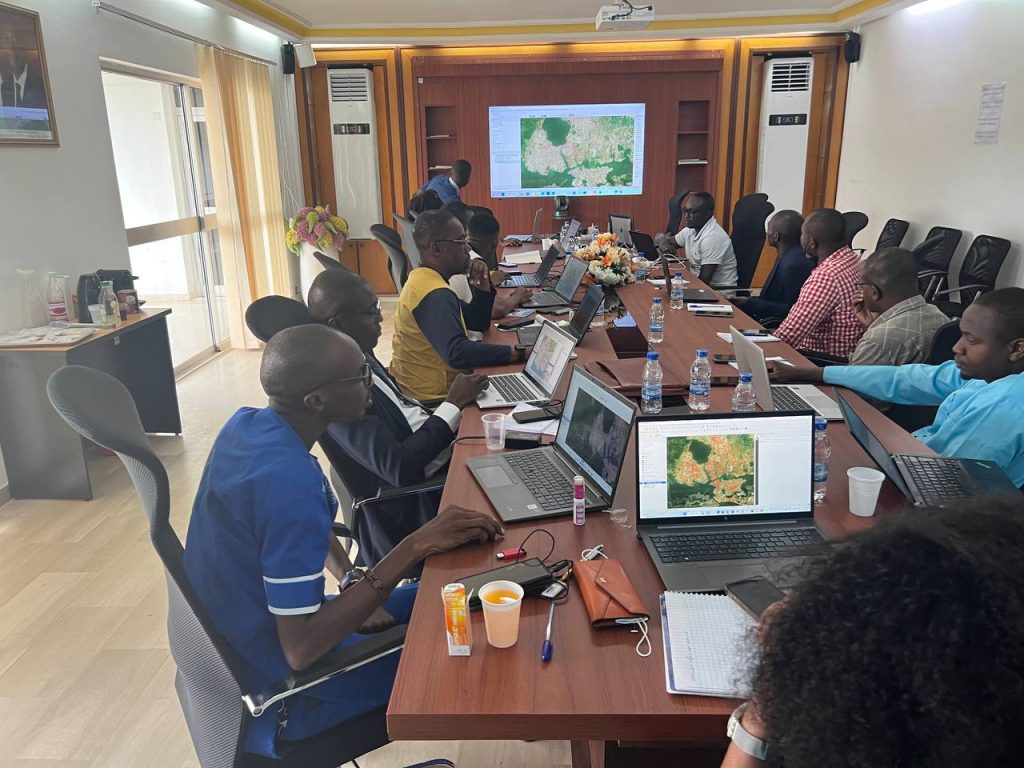
Three-day workshop on the use of digital technology in transport and the GTFS for mobility stakeholders in Greater Abidjan
In December 2022, a 3-day training on digital applications in transportation and GTFS was organized for the agents of AMUGA and representatives of transport operators (Sotra, STL, Citrans) it was conducted by Data Transport and supported AFD and World Resources Institute through Digital Transport For Africa initiative. This training was an opportunity for transport professionals
Partager :


Sustainable Mobility Requires a New Policy Approach Today
The world economy is changing rapidly; with an abundance of new opportunities, come new risks and vulnerabilities. As countries around the world undergo a fundamental reconfiguration to adapt, making the right policy decisions has become more challenging than ever. Transportation and mobility are key components of the well-being of our daily lives and livelihoods and
Partager :


MobilityData GTFS Validator Version 2 Is Available.
Version 2 of the GTFS static validator edited by Mobility Data is now available. This Validator helps to validate the GTFS static dataset quality. All details about the validator can be found here: https://github.com/MobilityData/gtfs-validator
Partager :

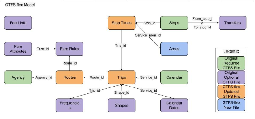
Do GTFS-FLEX Standard Adapted for African Informal Transport?
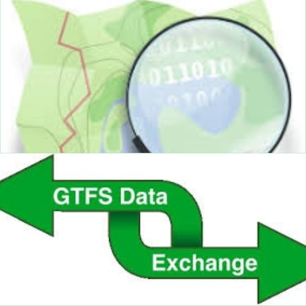
Do GTFS-FLEX Standard Adapted for African Informal Transport? GTFS “General Transit Feed Specification” is a standardized open data format for public transport timetables and associated geographical information (network topography: stop locations, line layouts). The GTFS Static format allows transit agencies and public agencies to publish data in a format that can be exploited and used
Partager :

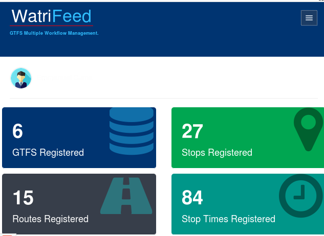
WatriFeed-API :Web API to support transport data processing for Africa
WatriFeed-API is an open source Web API, designed and developed by the Data-Transport project team. The main goal is to provide daily information to developers, to enable them to implement solutions based on the transport network. WatriFeed-API offers a programming interface (API) that allows developers to make the most of the data on the urban
Partager :

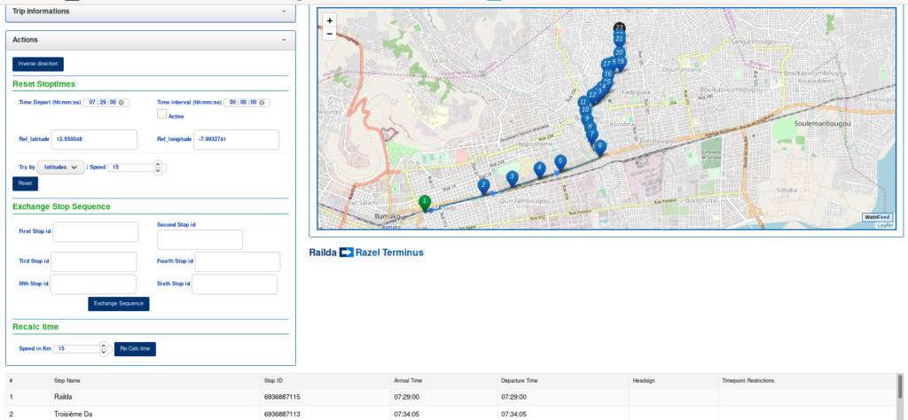
How to create a GTFS with WatriFeed trough OpenStreetMap data ?
How to create a GTFS with WatriFeed trough OpenStreetMap data ? WatriFeed-GTFS-Manager: The OpenSource Collaborative GTFS Data Editor. WatriFeed is a collaborative web editor for GTFS data developed by the Data Transport project labs to standardize transport data for easy use in transport and mobility applications and services. Step I: Import of OSM data through Overpass Turbo The first
Partager :

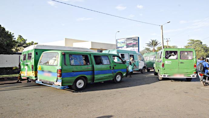
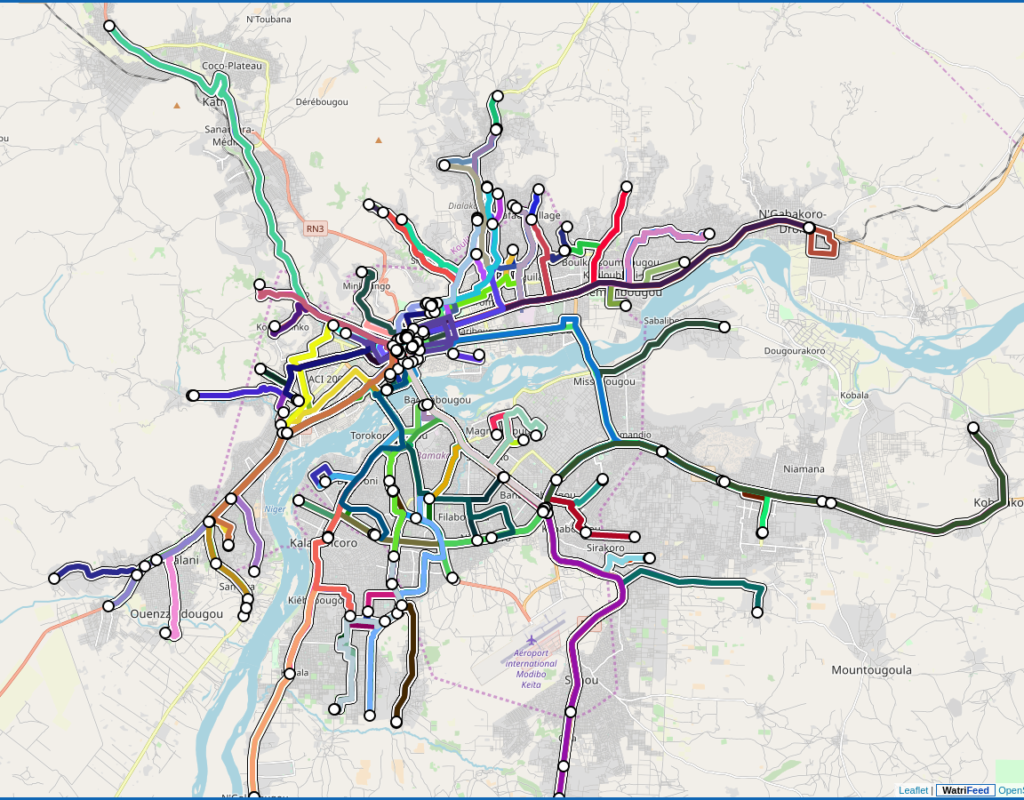
Mapping public transport in Bamako ” Sotrama “
Mapping public transport in Bamako ” Sotrama “ Bamako is a very large city by its size and population. It is served mainly by several modes of public transport such as mini-cars with a capacity of 12 – 25 seats called “SOTRAMA”. The SOTRAMA network serves the city with buses of 12-25 people capacity on
Partager :

WatriFeed: The OpenSource Collaborative GTFS Data Editor.
WatriFeed-GTFS-Manager: The OpenSource Collaborative GTFS Data Editor. WatriFeed is a collaborative web editor for GTFS data developed by the Data Transport project labs to standardize transport data for easy use in transport and mobility applications and services. The GTFS “General Transit Feed Specification” data format is a standardized open data format for communicating public transport timetables and associated
Partager :

Les Ressources numériques sur le Transport
Retrouver toutes les ressources numérique dédiées aux transport et aux format GTFS GTFS “General Transit Feed Specification” ( spécification générale pour les flux relatifs aux transports en commun) est un format de donnée ouvert standardisé pour communiquer des horaires de transports en commun et les informations géographiques associées (topographie d’un réseau : emplacement des arrêts, tracé
Partager :

OSM2GTFS : Transformer les Données de Transport OSM en GTFS
OSM2GTFS est un script qui permet de convertir les données de transport provenant de OpenStreetMap et de donnée de planification externe en format GTFS. Le code source du script est disponible ici : github.com/grote/osm2gtfs. Cas d’usage et manuel d’utilisation basé sur le projet Accra Mobile 3 : https://bit.ly/2JMwysU Je vous invite a découvrir également l’application


