


Mapping public transport in Bamako ” Sotrama “
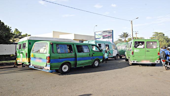
Bamako is a very large city by its size and population. It is served mainly by several modes of public transport such as mini-cars with a capacity of 12 – 25 seats called “SOTRAMA”. The SOTRAMA network serves the city with buses of 12-25 people capacity on certain assigned routes and certain unofficial, tolerated routes. The price for a trip ranges between 175 FCFA and 350 FCFA.
SOTRAMA in reference to “Société de Transport du Mali” they are controlled by the syndicate (not by the government) and the syndicate is divided into two sections by the Niger River ( right side and left side) and are operated by private operators who organise themselves along lines.
It is the privileged transport mode of the Malian citizens of its capital, more than 80% of them use the services of this transport mode, because it is the most cheaper. The price of a trip depends on the distance and ranges from 175 FCFA to 350 FCA.
The World Bank, through GFDRR (the Global Facility for Disaster Reduction and Recovery), is initiating and financing a project to map urban transport in Bamako.
Billet Express Mali through the Data Transport project is the startup responsible for the implementation of the project, working closely with the OpenStreetMap Mali community within the scope of this project, particularly in the collection and mapping of SOTRAMA lines.
Further details of the project are available at : Wiki Mapping Public Transport in Mali


